Showing posts with label GPS. Show all posts

5/27/2019

Heart Rate Monitor ~ chest strap v.s. wrist sensor??

What heart rate monitor is good for hiking?
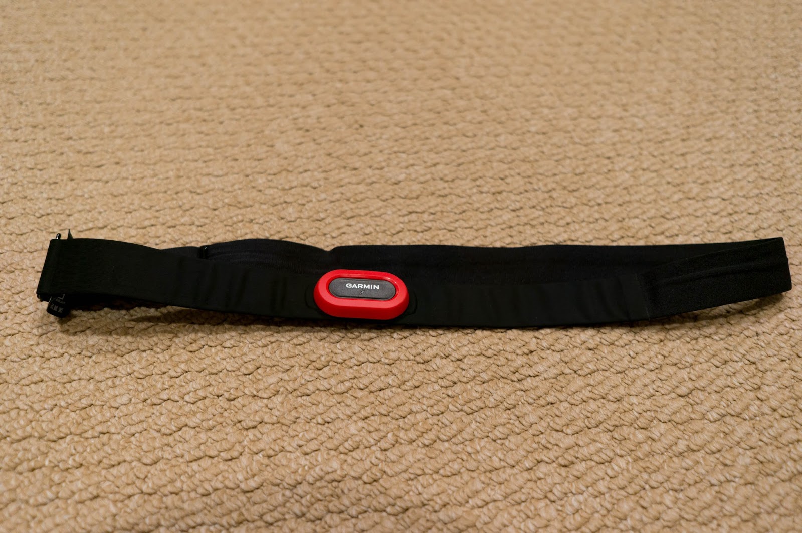
Chest-strap heart rate sensor

Embedded wrist heart rate sensor


There are a lot of devices which have heart rate sensors!!
Running devices, activity tracker, Apple watch and so on!
A several years ago, most of heart rate sensor for running was chest strap type.
Now, it is getting popular to use embedded heart rate sensor in a device.
I had a comparison about the accuracy!


Offset of measured heart rate between a chest-strap sensor and embedded wrist sensor

Offset of measured heart rate

I collected heart rate data based on my regular running exercise for a month.  I was wearing the both type of heart rate sensors, a chest-strap type and an embedded wrist sensor when I ran.

The chart above is the offset of the both measurements.  More than 90% of samples are within 4 (bpm).    This shows the embedded sensor is probably accurate enough for running and hiking.

Here is an example which has larger offset:

An example of larger offset 
The orange color is a data captured by a chest-strap sensor (with Garmin Forerunner 910XT).
In the middle of chart, there are some portion where the offset is bigger.  However the reading is more than 180 (bpm) which is probably way bigger for mild jog.  Therefore, I assume this data captured by a chest-strap sensor might be something wrong.

Another example is the the following:

Another bad example with larger offset

The blue color is captured by an embedded writ sensor (Garmin Vivosmart HR).  The early part, there are some spikes.  This data captured by an exercise using StarMaster in a gym.  It is hard to believe there is such spike during the exercise since the type of exercise won't introduce such narrow heart rate spikes.  Therefore, I assume this would be wrong reading by the embedded sensors.

Conclusion:The both sensors might have some wrong reading!

The both example shows there might be some wrong reading for the both sensors.  It is hard to identify the reason why the reading gets some offset.  Overall reading is matched well.   I think as long as contact between the sensor and body is good, the reading can be accurate.
My best guess is that if the contact is getting loose or dislocate a proper position to the body, the reading might be offsetting.

When people using a chest-strap sensor, it is probably easy to dislocate position due to a backpack.  I think that would be one of issue when I use the chest-strap type sensor during hiking.
Therefore, I would recommend embedded wrist sensor for hiking!


This device is with GPS function and it can track where you hike.


This device has pulse oximeter function, but no GPS.
It might be good to see your oxygen saturation which might be a good index for your body reaction of elevation!


5/22/2019

InReach ~ Save you in emergency situation during Hiking!

Just in case in Hiking!

It is very hard to predict what will hapen during your hiking!
You may want to prepare for unexpected accident during hiking!
InReach is a good system using a sattelite network

Many people enjoy hiking.
I am also the one who often go hiking / backcountry skiing.  Even the coverage of mobile network is improving, there are many areas where the coverage is not there.
In case some emergency, it is better to prepare a way to communicate with other people in anywhere!

I mentioned about Amateur Radio before.  Although Amatueur radio requires a license to use it, InReach does not require any license and a better coverage than Amatueur radio.
You may want to consider to have InReach for your future hiking!

Emergency communication?

The mobile network coverage is getting better, however, areas where people visit for hiking do not have very good coverage.  You may want to have an emergency communication method just in case, such as loosing your way, unexpected accident and etc.

One of good systems is Garmin In Reach which uses a satellite network for such communication.


InReach for emergency communication

What is convenient?

Have you heard about satellite communication system?
It is a system using a satellite network and many people believe it is expensive.

InReach is a system to send a text message to other mobile devices such as smart phones and e-mails.
Even if the typical mobile network is out of coverage, it can work if you can see sky!
Thus, it would be very reliable emergency communication system.

The cost is starting from just  US$ 11.95 a month as of May 2019., which is not very expensive to maintain.

Also you may have a rescue plan which can an emergency resucue cost.
The plan also starts about US$ 200 a year.  It may cover up to US$ 100,000 for rescue.

If you air-lifted by chopper, depending on a case, it could be very expensive for you.
It would be safe to have such plan just in case.

It is possible that you cannot move by yourself due to an accident.
You can ask a rescue by pusshing "SOS" button, then they will start rescue based on a location
provided by its GPS.

You never know what happens to you in hiking

It is very hard to predict unexpected accidents during hiking such as falling rocks, avalanche and etc.
Anything could happen any time!

Whenever you have an accident in anywhere, InReach helps you to send your location based on the GPS and asks rescue for you.  Even if you are alone or now other people near you, it could be possible to send SOS and contact to your family and/or friends in an emergency situation.


For you insurance policy!

It is probably better to have InReach as your pertner when you go hiking!

8/28/2018

Mt. Whitney Hiking 2018 (5) ~ All day heart rate data during hiking


All day heart rate on August 18, 2018


All day heart rate on August 19, 2018

What does heart rate trend looks like during hiking days?

The last a couple days, I reported overall walking time and heart rate for this hiking.
Today, I looked into a trend of heart late all day during hiking other than walking time.

Here is what I did for this hiking, I left home early in the morning on August 18, 2018 and came home late on August 19, including 6~7 hours driving one-way.

The first day (August 18th), I woke up around 3 am and left home at 3:40 am.  Heart rate during sleeping is around 55~65 (bpm).  During driving, it is somewhere 80 (bpm).  When I took a rest, I was moving around.  The heart rate a little jump to around 100 (bpm).

Time to arrive the visitor center in Lone Pine to pick up the permit around 9:30 am and left there before 10 am.  The elevation of trail head, Whitney Portal is somewhere around 8000 feet.  However on the way to trail head, the heart rate started up to more than 90 (bpm).   When I was preparing hiking near trail head, the heart rate reached 100 ~ 110 (bpm).

During hiking, that was what I reported last few posts.  As soon as I started walking, the heart rate hit more than 150 (bpm) as I mentioned in the previous posts.   When I took a rest with sitting, the heart rate got lower, but it was up to 120 (bpm).  It seems that the heart rate stay a little higher even I completely stopped and rest.

After setting up tents, the heart rate was stable somewhere around 110 (bpm).  However, it hit 150 (bpm) when I took water near the camp sit with a little walking.  After that I took the watch off for charging.   When I prepare meal in the tent, the heart rate was getting a little higher whenever I moved.  Overall, it was slowly getting lower, it was around 100~110 (bpm).  During sleeping, it was continue to be lower and right before waking up was somewhere around 70 (bpm).

However, whenever I started moving in the tent, the heart rate was getting higher again.  It was around 90 (bpm)

The second day, I carried minimum stuff for the summit attempt and I managed my heart rate less than 140 (bpm) as I mentioned in the previous posts.  Overall, the heart rate during hiking was 135 ~ 145 to the summit and the rest was somewhere around 120 (bpm) and the peak was a little more than 130 (bpm) during descending.

On the way back to home, the heart rate stayed higher than usual, which was around 100 (bpm).  When I came home, it was 84 (bpm).   I did not show a data during sleeping after coming back, but the heart rate was higher than usual, the starting was 80 (bpm).  However it was back to normal in the next morning which is somewhere around 50 (bpm).
My typical heart rate during sleeping is 45 ~ 55 (bpm) and heart rate during desk work is somewhere around 65 (bpm).  So it is obviously higher heart rate when I stay higher elevation during the hiking even in the tent.   Also, the data shows it took longer time to be back to normal even if the elevation is getting lower.  It is different from a regular training (running).  It is back to normal after a few hours.

Only one data, but....

This time I collected heart rate date all day during hiking.  However this is only data I have now.  It is hard to conclude anything.  However, the heart rate when I stay in higher elevation is expected.  It is just higher than usual.   On the other hand, the recovery time to back to normal was taking much longer time than what I was thinking.

It is still a speculation, however, I guess it takes much longer time when people are in lower oxygen situation.  With other data such as pace / total time, I think it is probably better to minimize the consumption of oxygen during hiking.  It is probably less impact overall.  Once people walk higher pace to consume a lot of oxygen, it might be hard to recover especially lower oxygen environment.  So that it might help to walk slowly to minimize oxygen consumption.

(To be continue)

8/21/2018

Mt. Whitney Hiking 2018 (2) ~ Data analysis for the first day

Heart Rate trend for the day 1


Walking Speed trend for day 1

Elevation trend for day 1
Data for the first day

As I always do for each hiking, I captured GPS / HR data by a GPS running watch.  Here is the analysis result for the first day of the hiking to Mt. Whitney this year.
As a result, the total time from the trail head (Whitney Portal) to Trail Camp where I camped was:

  • Total Time:    271    minutes (including resting time)
  • Resting Time   14.2 minutes

The distance based on the GPS data is 7.4 miles (11.9 km).
To compare data from different years, some reference point (location) is picked from a map with latitude and longitude.  Based on the location data, a program looks for the GPS data entries within 50m from the reference point.  Then, the program will check the minimum duration for each section.  Since GPS and distance calculation in the GPS device has some error, the measured distances are not the same for each year.  The average distance of this section (Trail head - Trail Camp) in the past years is about 6.5 mils (10.5 km) .  So that the distance measured this year is about a mile longer than the average.  However, this is not an important parameter for this comparison.  This comparison is focusing on the total duration, therefore it is not a problem.

The following is the past duration in the same section:
  • 2011: 264 (min) (Resting: 56 min)
  • 2014: 276 (min) (Resting: 65 min)
  • 2015: 266 (min) (Resting: 64 min)
  • 2016: 310 (min) (Resting: 81 min)
  • 2018: 271 (min) (Resting: 14 min)
(*) Note: The definition of resting time is the walking speed is less than 20 m / min.

Based on this data, this year is 3rd fastest after 2011 and 2015.  The big difference is much less resting time this year.


Actual feeling?

Here is what I felt during hiking this year.  Overall, my condition was pretty good.  I had 4 hours sleep at home before left home.  Just thinking about long driving during night, this would be a better than other years and it was not too bad at all!

However.......

When I started walking from the trail head, the heart rate jumped to more than 160 bpm right away even if the walking pace was not so fast.  I guess this is probably due to lack of training for ascending before the hiking.  I think my muscle strength was not enough and it was easy to increase the heart rate.  Therefore, I was very carefully manage the heart rate with slower pace from the beginning of this hiking.  The target range I set was somewhere around 140 ~ 155 bpm. 

Duration for each key section

Let's look into more detail!  A section from Whitney Portal to a branch to Lone Pine Lake, I took about 103 minutes.  I thought I was walking very slowly.  However it is very similar time as year 2014, 102 minutes  which was the fastest duration in the past.  The difference between the years are resting time, it was 12 minutes in 2014, but only 6 minutes this year.  It is the half of 2014.

The next section is from Lone Pine Lake branch to Outpost Camp.  It is relatively flat section and the fastest duration in the past was 28 minutes in 2011 which includes 3 minutes resting time.  This year was 30 minutes without any resting time.

The next section is probably the most tough section in the first day which is from Outpost Camp to Trail Camp.  The best duration in the past was 125 minutes in 2015 with 37 minutes resting time.  This year was 132 minutes with 9 minutes resting time.

Please note, the sum of duration for each section does not match the total time I showed in the beginning.  This is because, each reference location is defined within 50 m range and calculated the duration with the shortest duration between each reference point.  This means the moving time with in the 50 m range for each section does not include the time.  Thus, this is not an error.

Distribution of heart rate zones

The heart rate zone distribution for the first day, almost 80% of time, it was less than Zone 2.  Except 2012, that I hiked a friend who did not have a lot of experience in high elevation, therefore the overall pace was significantly slowing down.  The rest of years, Zone 3 distribution was more than Zone 2.  That is the major difference for this hiking.   This is a similar experience from Trail Camp to Summit in the other years that I kept my heart late below Zone 2 and I did not have to take resting time a lot.  I think if I keep my heart late below Zone 2, I could move without much resting for long time.

Overall, the total duration was not taking long time I originally thought during the hiking even if the walking pace was relatively slower than the other years since the resting time was significantly shorter than the other years.  Also, I felt it was one of easy hiking comparing the other years.


Summary of the first day

I think I am pretty sure that walking pace management based on the heart rate is really efficient method to manage the pace during hiking especially in higher elevation.
This year, the heart rate was much higher than usual and I intentionally kept slow pace and it helps overall duration in day 1.

(To be continue)

8/14/2018

Mt Whitney Hiking ~ Plant to be there this weekend!

From the main ridge of Mt. Whitney

I have not updated this blog for a while, I could not spend a lot of time for outdoor activities this summer due to many thing I need to do.  However, I find some time to hike Mt.Whitney this summer.  As I originally planed, this weekend would be the time!
Now I am preparing the hiking!!

Confirmed the reservation

First of all, I have just confirmed the reservation on the reservation site.  People need to confirm the reservation 2 to 14 days before the reservation, otherwise the reservation will be canceled.  It is very important to keep the reservation.   It was last minutes this year, but I have done!

まずは、予約サイトで予約の確認を行いました。予約の日の2日から14日前の期間に確認をしないと予約がキャンセルされてしまいますので、重要です。今回はギリギリになってしまいましたが、予約を確認しました。

Stuff to carry

This time, it is mid August and I do not have to worry about snow.  I do not need anything special this time.  Therefore, the plan is to minimize what I carry and do easy hiking!  I plan to wear hiking shoes instead of heavy boots this time.  I do not have to buy anything new except a gas canister and foods.   Only thing I need to do is to check all equipment.

  • Tent / Pads
  • Sleeping bag
  • Water treatment
  • Water bottle
  • Jackets
  • Cooking ware
  • Stove
  • Bear canister (*) must be required!!
  • Cap
  • Sun screen
  • Trekking poles
  • lighter
  • foods
Other than that, I will also ware the running watch with GPS / Pulse oximeter to monitor my heart rate and SPO2 during the hiking.   Also, I will carry amateur radio to check APRS coverage in the area.


I will report more detail after I coming back!

(*) FYI:  I also have another overnight reservation on August 31, 2018.  I do not need this any more and plan to cancel some time this week.   I am not sure when it comes back to the reservation site.  However it might be worth to watch the site if people are interested in to get it.

6/06/2018

Smart Hiking (3) ~ How to recognize "sign"

Difference between casual hiking in high elevation and Himalaya expedition?

One thing I can tell is that there is some difference between a casual hiking in high elevation, which is somewhere around 9,000 ~ 15,000 feet and mountains in Himalaya.
A major factor is "duration".   In general, those expeditions can be long enough to acclimatize the altitude up to some elevation.   However most of casual hiking could be done within a few days.   I think it is probably not long enough to acclimatize the elevation.   This means some symptoms for high altitude sickness is probably given and I think the key is probably to minimize the impact of the elevation.  That is a big difference.

On the other hand, most of strategy people believe is a similar way as those expeditions.  Something like staying higher altitude in a previous night....   However, I personally do not believe it helps a lot.  Based on my experience, I did not really realized that I was getting some symptoms until I really have obvious symptoms.  I think that is difficulty of such hiking.

Need some clear factor to quantify the impact to human body

Especially in early stage or the elevation is probably not high enough to see very clear symptom of high altitude sickness, most of people think "I am good".  Then people tend to walk a regular pace as lower elevation based on their experience.   People who has a lot of experience in that elevation, they might have a better idea how they can manage the pace with the elevation.  In this case, it is probably less problem.  The problem is many people do not have a lot of experience above 10,000 feet.   Therefore, they might walk over pace and exhausted.

If people can have a good factor to recognize the impact, it might help to adjust the pace.

One of popular factor for high altitude hiking / climbing is probably SPO2 (Peripheral Oxygen Saturation).   The value can be measured by pulse oximeter and many expedition might use it as a reference for altitude acclimatization.   If people measure SPO2 in lower elevation like lower than 1000 feet, then the value is typically more than 95%.  However if people is getting higher elevation, this value is getting lower.  Based on my experience, SPO2 valur in 14,000 feet was sometimes less than 80% which is really low value.   It is probably a good factor to show some impact to human body in higher elevation.  This value could be lower once people acclimatize the elevation and it is a good factor for acclimatization.   It is probably very useful for the expeditions.  But it is probably a little hard to use for hiking in a short period.

Another one is probably heart rate.  I am also runner and using a running device (watch) with GPS to track all race and training data.  Many devices nowadays can capture heart rate during the activities.  I also collect heart rate data during hiking to Mt. Whitney which is more than 14,000 feet.  I realize that the heart rate is getting higher if I am in higher altitude even waling pace is slower.
Also, heart rate is one of very good factor to manage the strength of a training and manage running pace in running world.   Therefore, I believe a similar idea can be applied to hiking.   That is the idea to manage walking pace in higher altitude during hiking.

I will show some examples which indicates some impact of higher elevation.

(To be continue)


5/05/2018

Garmin Forerunner 645

Forerunner 645

Forerunner645 is available!

I have not checked Garmin web site for a while and I found out Forerunner 645 is available. The price is USD $399.99.  The feature is probably between Forerunner 935 and 735.  Battery life is shorter than Forerunner 935.  Forerunner 645 is up to 7 days as a smart watch,  14 hours with GPS.

Overall, it is probably good enough for regular running and hiking purpose.   Major difference between 935 and 645 is "Training Stauts" and "Training Load" features that fenix 5 also has.

I have fenix 3 HR which does not have those features, but I do not believe they are really important features.  It is probably "nice to have" features.

Based on the price, price for Forerunner 735 is reduce to USD $349.99.  So 735 is attractive for price point of view. 

The other feature I found is this has "Garmin Pay".  It seems that it is a similar feature like "Apple Pay".  Garmin watch really becomes "smart watch" now.  For most of people, Apple watch might have more "nice feature", however for runners / hikers, I guess Garmin watch is probably better due to longer battery life.

For now, fenix 3 HR is probably good enough for me and I do not plan to replace any new product.  However, people who look for a GPS watch, it is probably worth to look around the new products.

3/27/2018

APRS ~ the packet is not recognized in some location


APRS stations near Brentwood
(There is one DIGIPEATER on Mt. Diablo)

  After testing APRS a couple different location, it seems that it is hard to send out the packet in some locations.   In my commute route, somewhere between Fremont and San Jose is one of locations.   I also went to Brentwood where might be a similar.
   For the commute route, it does not depends on the output power.  Even if I set the output power higher which is 8W instead of 1W.   I do not see much improvement.   It seems that it is just because more traffic.   From home to Fremont, almost all locations I sent was recognized, but after Fremont, probably a half of sending is missed.   A similar thing happened in Brentwood.   I tried to use 8W in Brentwood, it does not seem to help.   Instead of using higher power, it helped sending more frequently.   Then one out of ten was recognized.  In Brentwood, I did see more packets were going on.   If there is a lot of traffic, I guess using hand held might be some disadvantage.   Many mobile radio or base station might be more power something around 25W to 50W with probably a better antenna.
   It might happen when I use it on a trail.  Even if the location is better, it might be a similar situation.   So I really need to go hiking to try to see if it is still useful or not.   Originally, I thought it can be picked up if a DIGIPETER or IGATE station are reasonably close.  But it does not seems to be. 

3/20/2018

APRS - sending SMS message


SMS message from APRS

I was looking for a way to send a text message in the both direction from / to amateur radio.  The one I mentioned in the previous post is one-way communication from an amateur radio to a mobile device via E-mail.   We cannot reply to the message on the mobile device side.   That is a big limitation for the communication.

After I checked the web site of APRS, there is another service through SMSGTE (APRS/SMS Gateway).   This method provides communication in the both direction with some limitation.  I think it works.

Here is how it works:

  1. Using "SMSGTE" instead of a call sign when people send a message
  2. In a message body, inserting "@xxxxxxxxxxx " (xxxxxxxxxx is a phone number) to specify the destination of SMS message.
As long as the packet is going through to APRS-IS via IGATE station, a message can be delivered to a mobile device.   Also the person who received the message can reply to the message with in 30 minutes from the last message.   I tested this scheme in some different location with disabling cellular network data.  Now this might be a way to send a message even if a cellular network is out of the range.  Now APRS is probably very useful on a trail during hiking.

If you carefully look into the site, the service is provided in limited region.  The United States is one of countries where the service is available.

  • We can send out a location information periodically and people can trace the location from the internet.   (To trace the location history, no amateur license is required)
  • We can tell stations who is close to the current location.   Call-signs are listed and they can exchange messages each other.  It is probably useful to contact those station in case people needs some assistance.
  • We can send SMS message to any mobile device. (limited countries)
To use APRS, people need to get amateur radio license, but I think it worth to get it.   It helps a lot in case something happens during hiking in an area where a cellular service is not available.

3/11/2018

APRS ~ Test from home with rubber ducky antenna

   Today, I tested APRS with BAOFENG/iPhone from home in daytime.
   There are two digipeater near my home.  Based on information on "https://aprs.fi", one digipeater is about 5.3 miles from my home and the other is about 16.1 miles from my home.  Since I do not have any base station antenna, therefore I just use the rubber ducky antenna in a room and set the output power as a low power (1W).

   It seems the both digipeaters can pick up my APRS packet and I can see some packets from other station through those digipeaters.  At least it works around my home with low power setup.  Also, today, I did not see any unexpected transmission at all.   I guess some setup yesterday might not be right.

The current setup is:

On PocketPacket:

  • VOX trigger is 400msc
Radio:
  • VOX setup value on BAOFENG UV-5R is "10"
  • The volume is middle position
iPhone:
  • Volume setup is the maximum on iPhone
It has been running more than 2 hours and I saw some stations near home.  The next step is trying to use this on a trail.

3/07/2018

APRS with BAOFENG UV-5R ~ I just order a cable from Amazon!

   As an experiment, I confirmed that transmitting a APRS (AX.25) packet and the location shown in a map.   I am looking for a solution to receive packets from the other stations.  The problem is the cable connection between iPhone and the radio.   I do not have any extra cables to get the connectors.

   After some web search, I found a cable on Amazon!!

BTECH APRS-K1 Cable

I just ordered the cable on Amazon and it is expected to deliver on Friday.   Once I get the cable, I will try it and to see if it works or not.


APRS ~ BaoFeng UV-5R + iPhone app "PocketPacket"


Pocket Packet can be used with a 2m radio
   The previous post was talking about two smart phone applications which send the information through cellular network.   During its research, I found some information on the internet that "Pocket Packet" application can be used as TNC (Terminal Node Controller) and BaoFeng can send out the information from audio output from iPhone.  With this solution, it does not depend on the cellular network.   A smart phone is only used to get the GPS or the location information and generating a packet information as the audio output.   No data is going through a cellular network.

Pocket Packet Setup, BaoFeng setup and cable connection

   First of all, disable APRS-IS connection.   As a smart phone application with a cellular network, this function is the path to APRS-IS server.  Width disabling this portion, the application won't send any data to APRS-IS server.   It is also OK to disable "Cellular Data" on iPhone.
Disabling APRS-IS connection
(Turn off "Enabled" and "Transmit")

  Second, enable "Audo Modem" setup on "PocketPacket" setup.  This is a function to create audio output which includes the location information.


Enabled Audio Modem
(Turn on "Enabled" and "Transmit", see the green switches)

  They are the key setting to use a radio to transmit via amateur radio.  Then the last thing is connection between iPhone and a radio (transceiver) .   The article I mentioned above is using a custom hand-made cable for this connection which has a connection from "audio output" to "microphone".
   Since I do not have any extra head set to get connectors on the both end.  I just using a stereo audio cable with 3.5 mm standard jacks on the both side.   I put it to the iPhone ear-phone jack and BaoFeng microphone jack.  Then enable VOX function on the BaoFeng side.
   The frequency for APRS in north America is 144.390 MHz.  In my case, I set iPhone volume as the maximum and set BaoFeng VOX to 5.  Since this is just 1-way connection and no incoming packet is routed to iPhone.  So this is just a test to see if we can send out APRS AX.25 packet through amateur radio.   (My iPhone is an old iPhone5 which has audio jack.  Newer models (after iPhone 7), it is requires to use a short cable to connect audio cable.

   With above setup, it was successful.   I can see my data on aprs.fi.

Trace when I was driving


  It is a good news, we can use iPhone as TNC with most of handheld radio with VOX function.  "PocketPacket" supposes to get incoming packet if we have connection from the radio.  I have not tried this yet.  But I will try it and post the result.

   I guess this might be a good low cost APRS solution through amateur radio!

3/05/2018

APRS -- Easy solution ~ iPhone App

   I mentioned about APRS (Automatic Packet Reporting System) a few weeks ago.   I am looking for a solution for my future hiking to trace my location during hiking.   In case something happens to me, it can be a way to help to find out where I am.  That is my motivation to use APRS.

   There are some handheld radios which has built-in APRS features, but the price of the radios are expensive.   For long term, I am considering to get such radio in the future.   However I am looking for something low-cost solution for short term.

iPhone App - "aprs.fi"
   I think one of lowest cost solution is a smart phone application.   There are some applications in AppStore.   My smart phone is an iPhone and I did not search Android apps.   "aprs.fi" is the one which is listed as the first app when I search "APRS" in AppStore.   It is USD $6.99.   It is an application on an iPhone to send the location information through cellular network, not through amateur radio.   Therefore, it won't work if a location is not covered by a cellular network.  It is different from one going through amateur radio.   Even though, it is still useful to use in local trails where majority of trails are still covered by a cellular network.

   There is a limitation that the location information is not really report to APRS-IS servers.  Therefore if people is not using the application or "https://aprs.fi" site.  The location information is not shown on the other application for APRS.   As long as people use those application, it is not a problem.   The setup is easy and this is probably an easy solution for most of local trails.  Since this is using a cellular network and utilize its data plan.  I think each data size is not really big, however if the interval to send the location information is short and long hiking, it will use some amount of data. 

Another App - "PocketPacket"
   Another iPhone application I tried is "PocketPacket" which is USD $4.99.   I think this application would be lower cost and better.   The setup is a little more than "aprs.fi".  However this application sends the location information to APRS-IS servers and any application can see the location.   So this is less limitation.   However, to send the information APRS-IS servers, it might requires "passcode".  (I am not really sure, but I think I get error without the passcode.)

   I just did an internet search and a site can generate a pass code with a call-sign.  The URL of the site is "apps.magicbug.co.uk".   I found it by a Google search with "APRS passcode".

The next post will talk about a way to send the location information through amateur radio!


2/18/2018

APRS for hiking and back country skiing


Tracking locations with APRS 

   The other thing I am interested in using amateur radio is APRS (Automatic Packet Reporting System), especially GPS information.   There are many similar system using the mobile network.   However, there is still a lot of area in mountain where any network is not covered.   Using amateur radio to sending out the location information and tracked by somebody else.  I think it helps rescue in case something happens during hiking and back country skiing.

   Since I sometimes went hiking / skiing alone and avalanche beacon might not be very useful if anybody does not see the accident.   However, this APRS GPS information might help to find out a rough location where the accident is.  It might be too late to rescue a person...... 

   Based on my research recently, there are a couple amateur radio hand held transceivers which can support APRS with GPS information.   The price is a bit expensive with the feature, but I am really interested in the feature.  So I am considering to get one some time and tried how it covers in areas I often go.   There is some digital transceivers made in China have GPS feature, but it is not very clear if they ca support APRS.  Some articles on the internet says it works, but it is not very clear it is really works.   The price for those Chinese transceivers are not very low cost like BAOFENG analog transceivers I got.   So I might need to do my research more.  Please advice if anybody has a better experience to use the location service with APRS.

11/18/2017

Resting Heart Rate and Training Progress


Resting Heart Rate last 6 mounts

   I posted about relationship training progress and VO2max and Lactate threshold.   I also think the resting heart late has some relationship with training progress as well.

    It is obvious that resting heart rate shows some conditions in short term.   For long term, it also show the training progress.  The plot above is average resting heart rate trend last 6 mounts.  When I resume the training the resting heart rate is getting lower.   Estimated VO2max and Lactate threshold, I only have data past 12 months since this is a new feature (data) in fenix 3 HR.  Previously, I did not have any device to get such data.   However, regarding heart rate, I had Vivosmart HR and I have a little more data than the others.  Based on my experience, the long term resting heart rate is probably a good factor to watch to see the training progress.

   Last a few years, including Apple watch, those "smart devices" are getting much better and collect various our body data to see many things in different aspect.   As I keep posting, they are good to to monitor our training activities, helping hiking, monitoring the progress, our body conditions and etc.
   I think even some low-end model has various monitoring features and they might be good enough to get some basic data for our daily training and supporting hiking.

   I really want to see what else we can utilize the devices.  I keep watching / looking for more useful way for those devices!

10/29/2017

VO2max Estimation by Garmin device

Garmin fenix 3 HR
which has VO2max estimation feature

VO2max

VO2max is one of performance factor for athletes.  Traditional way to estimate the number without special lab equipment is "Cooper Testing".   It is so called "12 minutes running".  Based on distance people can run in 12 minutes, VO2max can be estimated.
This number is also used for estimated marathon time.

Garmin Device can estimate VO2max

As I introduce a couple times in my blog before, the recent Garmin Running devices have a feature to estimate this VO2max number based on activities.   I think this is very good factor to see the progress of your training.

Actually, I have never measure my VO2max in lab before.  Therefore, I do not know the estimation by Garmin device is accurate or not.  But it seems that the number is close to the cooper test result based on my past data.  At least the absolute value of VO2max is probably not very important for most of people.   I think just having a relative comparison would be very useful.  As long as people using that way, the feature is really useful.  Even if we have some gap between the estimated value and the real value.

Benefit of the estimation by a device

For Cooper testing, people need to run really push to their limit, basically it should be "all-out".  This really high intensity training is probably really tough for many people except some serious athlete.   A good thing estimate by Garmin device does not requires really high intensity activity to get the number.  It requires to see the maximum heart rate and some accumulated activity data to get a reasonable numbers.  However after accumulating some activity data including some high intensity activities, even if an easy activities, we still can get some estimated number and it seems to be a reasonable.   I think this is a good benefit to get the number for each activities and understand the fitness situation.

This is one of features I really like in Garmin fenix 3 HR.


10/22/2017

Heart Rate base pacing ~ Update

Switch back in early summer
in Mt. Whitney trail

This year, I did not go hiking to Mt. Whitney.  I do not have much update.  However, I found out some additional thoughts based on recent date for my running activities.   Today, I just share what I found recently.

A good heart rate number for hiking?

As I mentioned before hear rate zone around zone 2 and zone 3 would be a good range for hiking based on my past hiking records.  Depending on how we define the heart rate zone, a good range would be 60 ~ 80% of the heart range, which is really wide range  In a reality below middle of zone 3 which is around 75% of the range would be a reasonable.  In my case, the maximum heart rate is about 180 bpm and my resting heart rate is around 60 bpm.  With those data, 75% of the range is is around 150 bpm.   Based on the past experience, this is really reasonable value for me.

Recent Running training
Here is my recent update for my training, due to a large wild fire around Napa / Santa Rosa area, the air condition is getting really  bad last a few weeks.   Schools started no PE outside and I also did not run outside last a few weeks.   I only did station bike indoor to maintain my fitness level.

Due to my age, which is over 50 years old, I realized the fitness level is easily getting worse if I do not do training a several days.   This is obvious my past training records this year with stopping training due to injury and vacation.

This time I have not run outside for 2 weeks and then my estimated VO2max and lactate threshold by Germin running device was getting worst a little even if I was doing station bike a few times a week.
Muscle for running is different from station bike and load to my body for station bike is much lower than running.  I found out that my heart rate is really easy to get high within a short period.  The estimated lactate threshold is around 165 bpm by a Garmin device.  However, I probably need to keep it below 155 bpm if I need to run more than 1 hour.  In my case, there is no problem since I set my running pace based on the lactate threshold and 155 bpm is in zone 2 with lactate threshold heart rate.  (155 bpm is zone 3 with reserved heart rate zone and zone 4 with a ration of maximum heart rate.

This weekend, the scheduled menu was 3 times of 55 minutes running with 5 minutes resting (walking) .  I could not have enough time for 3 times and I just did 2.5 times with total time 2 hours 20 minutes.  I maintained my heart rate between 140 and 155 bpm.  The average speed was 8:45/km and the average heart rate was 149 bpm.  This is very slow but this is what I can do now.  This value including 5 minutes working in the activities.  Therefore actual running speed and heart rate could be a little better.  (I did not have a separate lap data this time)

A generic target

In my case, I already have a good target heart rate based on my past data.  I have no problem to manage my pace with that number.  On the other hand, it might be heard to define a generic guide line for other people since 150~155 bpm in my case is could be zone 2 ~ zone 4 depending how I define the heart rate zone.
The key point is where the lactate threshold heart late is in.  If you have high end running device which can estimate a lactate threshold, then the number would be a good reference for the target.  People just need to know how much lower they can set as a target.  If people has less training, then it could be better to set 6~10% lower than the lactate threshold.  If people are in a good shape, then it could be enough to set a few percent lower than the lactate threshold based on my past data.

If you do not have any idea where the lactate threshold is, this could apply based on the training activities.   A rough guide line could be using zone 2 if people do not have much training  and using zone 3 if people has a regular base aerobic training (at least more than 1 hour once a week).
Anyway, zone 2 could be a good range for "easy hiking" in general in my opinion.   The definition of heart rate zone could be good using a ratio of the maximum heart rate (220 - age) I think.  In any cases, important things is to collect more data during your training / hiking to understand your heart rate reaction during activities.

I published a Japanese version of book about the heart rate based pacing method for hiking.  I am still working on an English edition.  It will take some time to translate to English and it is not easy job for me....... 

10/07/2017

Resting heart rate - Usage of Garmin fenix 3 HR

Heart rate trend on Sep 26

   Today's topic is a resting heart rate.  Previously, before I got a Garmin device which can monitor my heart rate 24/7, I used to check my heart rate right after I wake up.  Recently my Garmin device can monitor my heart rate 24/7 and it is easy to tell my resting heart rate.

   Based on the data, my resting heart rate is roughly 50~60 bpm.  This is also depending on a training progress.  If I stopped the training for a while, the number was going up.  On the other hand, when my training progress was getting good, then the number was going down.  The training I am talking here is an aerobic training.

   The other thing I found out recently is the number after a hard training or when I felt tired, then the resting heart rate is relatively higher.  The data I showed in the beginning is a heart rate trend on September 26 this year.   The resting heart rate right before waking up is about 52 bpm.   I also did an interval training after work.  That is why the heart rate in the evening is getting higher.

Heart rate trend on Sep 27

   The next day, the resting heart rate before waking up is 58 bpm.  The difference is small, but I can see a similar trend in the past.  The resting heart rate is usually higher if I have a hard training a day before.  Probably it is due to my age, I usually feel tired if I do a hard training a day before.  I guess the data for younger people might be different from what I see myself.   However, for my age, I guess it is probably better to take a reasonable resting to recover after a hard training.

   I expected to get a similar data on high altitude during a hiking like 14,000 feet elevation.  However, as I posted I could not go hiking this year and collecting / analyzing the data will be after next year.....   This would be an interesting data to understand my body reaction in high altitude!

9/08/2017

Garmin fenix HR feature ~ Estimating Lactate Threshold / VO2max

Lactate Threshold Pace (Last 6 months)

Lactate Threshold HR (Last 6 months)

VO2max (Last 6 months)

Lactate Threshold Estimation on Garmin High-End Running device

   The last posting was talking about VO2 max for a factor of training progress.  Garmin started supporting this estimating feature most of running devices (above Forerunner 35).   My device, fenix 3 HR, supports to estimate Lactate Threshold (LT) as well.

   The devices shows LT with LT Heart rate and LT pace.   I did not have very good idea how I use the both data.  I did not have enough data to talk about my analysis before.  Now I have probably enough data to talk about LT feature.  As I explained my training activities last 6 months in my previous posting:

  • April: Just finished "Full marathon level 2" training -- Good fitness condition
  • May:  Due to injury late in April, I stopped running about 4 weeks
  • June:  Resumed training, but stopped again due to FRU for 3 weeks
  • July:   Resumed training, every other days 5km - 10km, rested for 1 week in the last week
  • August - September: Started "Full marathon level 1", 3 times a week
  • September -- my health condition is not very well last a several days

   Since last a several days in September, my health condition has not been very well, but I did not take a rest.  Therefore, my performance was not very well.  That is why I do see most of factors are dropped in September.

LT Heart Rate

   The range of LT Heart rate last 6 months is 163-167 [bpm].  The delta between the minimum and the maximum is only 4 [bpm].   My opinion, this is not much difference, but I think slightly improved due to the training a little.  Even if I stopped training, it was not really getting worse.  As long as I tried to do something regular basis, this might not change a lot.  Maybe people who does not have training for a long time, it may be improved with some regular based training.

LT Pace

   The range of LT pace last 6 months is 5:31 ~ 6:23 [MM:SS].   The delta is close to 1 minute.  If I stopped the training, the number was getting worse and once I resumed running, it was getting better slowly.  The trend is very similar as VO2max.

My analysis

   I think LT HR is probably not much change as long as people continue to training for long time and LT Pace and VO2max could be a good factor to see the progress.  Either one could be used to measure the progress of the training.  Many models support VO2max estimation, but LT estimation is limited only some high-end model.   The high-end models have more nice features and the prices is much higher than other low-mid class models.   So if you just need a basic features, I think Forerunner 35/235 would be good.   Also 735 price is getting lower due to some other new models.

   The other factors, VO2max estimates works with the embedded heart rate sensor.  However for LT estimation, chest-strap heart rate sensor is requires.   Also, to estimate LT, people need to do relatively hard workout than VO2max estimation.  VO2 max estimation can be done with a light workout.  I am not sure how it is accurate.  But even I ran slowly, the value is a similar number as I did heard work out.   So with those factors, I would think VO2 max is probably more convenient in my opinion.


7/10/2017

Good time for hiking ~ Minimize impact of high altitude sickness during hiking


Yosemite National Park (July/2016)

   It is mid July and this is a good time for hiking.   Kids started summer vacation in the United States.  I think many people plans to go hiking this summer.
   I keep posting about a method to manage hiking pace based on heart rate with a running watch, activity trackers.   Finally, I published a kindle book last April in Japanese.  I have been working on its English edition now.  This book is based on my past data for Mt. Whitney hiking.  Mt. Whitney is very popular destination for hiking in California.  (Japanese Edition -- High Tech pace management)
  There are some mountains over 12,000 feet, that many people easily hike, such as Mt. Whitney, White mountain, Mt. Dana (which is in the photo in this posting.  If you have a GPS tracking data with heart rate, please share your data for my further study.

   As I mentioned, I am working on the English edition, but it will take some time.  Therefore, I introduce a simple method in this positing.  Please try this if you hike high elevation.

1. Estimate your maximum heart rate from your age
   A popular formula to estimate the maximum heart rate by age is "220 - (age)".  As an example, I am 50 years old and my estimated value is "220 - 50 = 170".  So that my value is 170 (bpm).  This value may not be very accurate.  Since the maximum heart rate depends on each person depending on the fitness and regular training situation.  However, this value could be a good enough as a placeholder or starting point.  (This is not a generic,  this is based on my past data)

 2. Calculate heart rate zone
   The next step is to calculate heart rate zone with a spreadsheet software like MS-Excel.   The calculation is to get heart rate number in 50% ~ 100% of the maximum heart rate by 10% step, which is 50%, 60%, 70%, 80%, 90% and 100%.  They are used to define each heart rate zone, the zone 1 is 50~60% range and zone 5 is 90 _ 100%.   The following is an example of my case.


Example of heart rate zones
3. A guide line of walking pace during hiking.
   Based on my experience, we need to stay in zone 3 which is 70~80% of the maximum heart rate or lower.  In my case, 119 (bpm) ~ 136 (bpm) or lower.

4. Heart rate monitor
   People can use an activity tracker, running watch with GPS, Apple watch to monitor your heart rate during hiking.   One for running, it usually has a feature to notify with alarm or vibration if the heart rate is out of a range people set.  This is really convenient feature to manage the walking pace during hiking.

5. When the heart rate is out of range, it is getting higher than the maximum limit.  Then, people need to slow down or stop to lower the heart rate.  If the duration over the limit is getting higher or the heart rate stays higher, I think it is time to take a rest to lower the heart rate.   If the heart rate is not getting lower with a rest, I think it is a sign to consider to stop hiking.  Especially, people feel some headache, nausea and etc, it is safe to stop hiking at that point.  Even people do not feel anything wrong, but the heart rate is staying high is probably a sign to stop hiking in many cases.


  In many article to minimize the impact of high altitude sickness, it is better to walk slowly.  However it is not very clear how slow.  This is a good method to define the pace with clear guide line.  I think this pace might be too easy especially in the beginning of hiking.   However, there is some gap between your feeling and actual situation of your body.   Therefore, it is better to see your heart rate is one of clear factor to understand your condition / situation.

   Please share your experience and data if you try this method.  It will help my further study on this topics.

   Enjoy your hiking this summer!