Showing posts with label Hiking. Show all posts

8/03/2019

Hike in Yosemiete NP !


August 3, 2019

Hiking in Yosemite NP

I went hiking twice within 2 weeks to Yosemite National Park this summer.

Due to a lot of snowing last winter, there was still a lot of snow on the trail.
It was much more than June in 2016!

Mt. Dana

From summit of Mt. Dana

It was my second time to hike to Mt. Dana.
Since I woke up late, when I arrived at the trail head it was a little before 11am.
The parking lot near Tioga Pass entrance was full.  However I got a parking spot with a little waiting.
It is probably better going there early to ensure to get a parking spot!

There were two sections where the trail was covered by snow about 300 feet.
Some people detour to avoid snow, however, I thought it might be much easy to hike straight.
I hike on the snow with an ice axe.

It have not had hiking for a while.  I was really exhausted.  The round trip was about more than 4 hours!

Gaylor Lake

Gaylor Lake

The second hike was today!
Since my family went there with me, I picked much easier one.
The trail head is also the same as Mt. Dana, but this one heads to north instead of south for Mt. Dana!

It was just 2 hours hiking from the parking lot.  It is much easier than Mt. Dana.  Just relax and enjoy very nice view around the lake!

Snow on a trail toward Mt. Dana was melted a lot.  There was still some snow, but it was getting much smaller than 2 weeks ago!


6/07/2019

Data analysis for hiking! ~ good to have heart rate data during training!

Data analysis for hiking

Heart rate is one of good index to understand training effort.
It is not only managing your pace for hiking, but also analyzing your training effort as well.

The following chart is heart rate distribution for a training last weekend.
I went hiking to a local trail for a training for hiking to Mt. Whitney this summer!

As you can see, the majority of my heart rate stays in Zone1.  This means this activity was pretty mild and easy effort.

The following chart is heart rate distribution for hiking to Mt. Whitney in 2018.

I managed my walking pace based on my heart rate and intentionally kept my pace very slow.
Even though, the almost half of time is zone 2 and it got into zone 3 a little.

The training last weekend is only three and half hours.  And hiking on the first day to Mt. Whitney in 2018 was about four and half hours with heavy backpack!

I got really bad muscle ache after the hiking and I was exhausted.
This indicates my fitness level was pretty bad! 

What would be a potential issue?

The essential issue for my fitness level is really lack of strength of muscle for ascending / descending because I did not go hiking after Mt. Whitney hiking in August last year.

Thus, I really needs to walk more hilly trail next a few month!


6/01/2019

Started training for Mt. Whitney hiking this summer!


Hike to Mt. Whitney from Cottonwood Pass this summer

As I mentioned a couple times, I will go hiking from Cottonwood to Mt. Whitney this summer.
This route is much longer than Mt. Whitney Trail where I hiked a several times in the past years.

I plan to hike there in September and I still have three months.
I just started training today!

Running is not enough!

I run 3 ~ 4 times a week, but I do not believe it is not good enough.
People need to train muscle for ascending / descending.  It would be hard to train just running. 

I think it is possible to train muscle for ascending with StareMaster in a gym, but muscle for descending is probably hard.   The best way is just go hiking to do ascending and descending.

I could not reach where I plan!

I went PG&E trail Rancho San Antonio County Park after I dropped my daughter at Japanese School.
I headed to Black Mountain within 2 hours.  However, I could not reach there and returned 1km before the destination.  Total 16 km with 3 and half hours.   It is obvious that my fitness level is getting very poor.

The heart rate is not really reach to Zone 3.   It was the first day, but I need to train on the trail every week to recover my fitness level.

It was bad and I do have muscle ache now!  Just for aerobic performance, it would be all right due to regular running exercise!

5/28/2019

Emergency communication ~ Amateur radio

Amateur Radio for Emergency communication

InReach is probably the best solution for emergency communication!
However, it is a little expensive!
One of alternate solutions could be Amateur Radio!!

Low cost solution

Although Amateur radio requires a license to use it, it is probably low cost solution in many cases.
One of very low cost radios from China is BAOFENG.  It costs about USD $30.

To get license you might want to check a test schedule in your local area.
You can refer the following link to find out an exam in your area:


Once you pass the exam, you can start using Amateur radio within a few weeks.

What you need to do for the exam is just going over the question pool.


To get Technician license, the majority of questions are a sort of "common sense".  Once you go through the question pool and you may be able to get the license!

APRS (Automatic Packet Reporting System) would be a good method to communicate from Amateur radio to email and text messaging to a mobile device.  It reports your location as well as text messages.  As long as you are on a ridge or a peak, there might be a good chance to communicate even if the area is out of the mobile network coverage.


More reliable communication for an emergency!

I still believe if you really look for more reliable communication method, InReach would be the best solution.  However, the cost is much expensive and you need to pay monthly / annual fee to get the service.  
The coverage is probably much better than regular amateur radio and it has a rescue plan that covers rescue cost as well.
If you are going to really long hiking like John Muir Trail, then InReach would be a better solution!


5/27/2019

Heart Rate Monitor ~ chest strap v.s. wrist sensor??

What heart rate monitor is good for hiking?

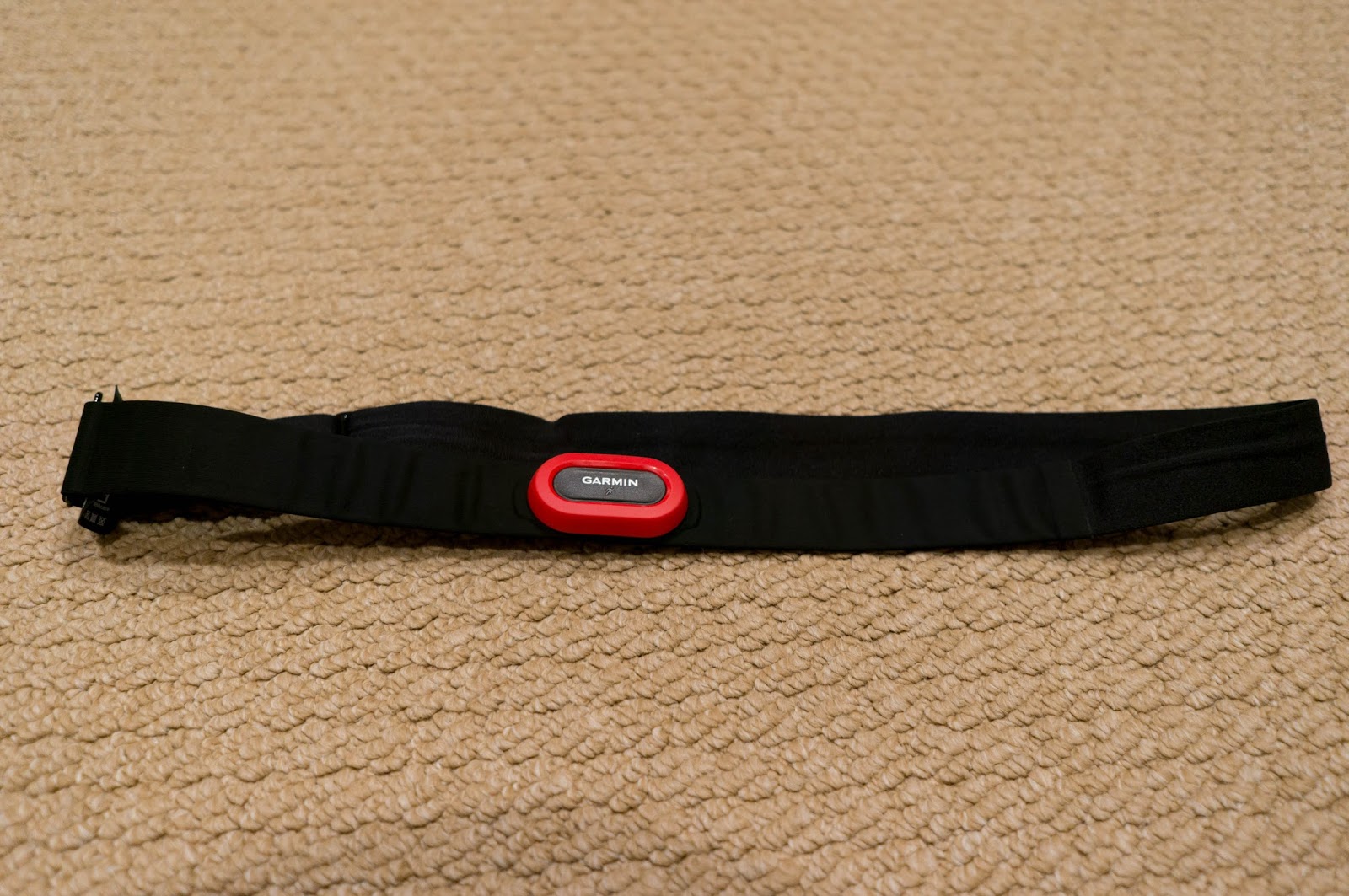
Chest-strap heart rate sensor

Embedded wrist heart rate sensor


There are a lot of devices which have heart rate sensors!!
Running devices, activity tracker, Apple watch and so on!
A several years ago, most of heart rate sensor for running was chest strap type.
Now, it is getting popular to use embedded heart rate sensor in a device.
I had a comparison about the accuracy!


Offset of measured heart rate between a chest-strap sensor and embedded wrist sensor

Offset of measured heart rate

I collected heart rate data based on my regular running exercise for a month.  I was wearing the both type of heart rate sensors, a chest-strap type and an embedded wrist sensor when I ran.

The chart above is the offset of the both measurements.  More than 90% of samples are within 4 (bpm).    This shows the embedded sensor is probably accurate enough for running and hiking.

Here is an example which has larger offset:

An example of larger offset 
The orange color is a data captured by a chest-strap sensor (with Garmin Forerunner 910XT).
In the middle of chart, there are some portion where the offset is bigger.  However the reading is more than 180 (bpm) which is probably way bigger for mild jog.  Therefore, I assume this data captured by a chest-strap sensor might be something wrong.

Another example is the the following:

Another bad example with larger offset

The blue color is captured by an embedded writ sensor (Garmin Vivosmart HR).  The early part, there are some spikes.  This data captured by an exercise using StarMaster in a gym.  It is hard to believe there is such spike during the exercise since the type of exercise won't introduce such narrow heart rate spikes.  Therefore, I assume this would be wrong reading by the embedded sensors.

Conclusion:The both sensors might have some wrong reading!

The both example shows there might be some wrong reading for the both sensors.  It is hard to identify the reason why the reading gets some offset.  Overall reading is matched well.   I think as long as contact between the sensor and body is good, the reading can be accurate.
My best guess is that if the contact is getting loose or dislocate a proper position to the body, the reading might be offsetting.

When people using a chest-strap sensor, it is probably easy to dislocate position due to a backpack.  I think that would be one of issue when I use the chest-strap type sensor during hiking.
Therefore, I would recommend embedded wrist sensor for hiking!


This device is with GPS function and it can track where you hike.


This device has pulse oximeter function, but no GPS.
It might be good to see your oxygen saturation which might be a good index for your body reaction of elevation!


5/25/2019

Are you ready camping in a rain?? ~ Gore Tex Sleeping bag cover!

Camping in Rain? No problem!

In case you need to camp in rain,  it is better to be prepared!
I usually use Gore-Tex Sleeping cover to minimize wetting my sleeping bag.


Memorial day weekend!

This weekend is Memorial Day weekend in the United States.  Our family usually go camping in Memorial day weekend.  Unfortunately, weather forcast says it will be raining.

We are discussing if we need to cancel the camping or not.  It is probably canceled.....

However, it is different story if raining is during hiking / backpacking.  You are not much choice.

Once your sleeping bag gets wet, it is not very comfortable the rest of nights.
To minimize the impact of raining, it is better to prepare in advance!

I am not sure why I cannot see sleeping bag cover in the United States.
In Japan, sleeping bag cover is very popular and it is very useful to protect from rain.

There are some sleeping bag with Gore Tex shell, it is probably one of better sleeping bags.
However, majority of sleeping bags do not have Gore Tex shell and it is easy to get wet if people are camping in a rain.

A solution is using Gore Tex sleeping bag cover, then it will be much better!!


5/24/2019

Tea / Coffee in Outdoor!! ~ Gas stove / cooker for picnic

Tea / Coffee in Outdoor?

How often do you go out and enjoy Outdoor activities?
Don't you think that it is a great idea to have some tea / coffee in outdoor?
Camping Gas Stove / Cooker would be a good gear to carry for hiking / picnick!!

Summer is coming!

This weekend is a long weekend, Memorial Day weekend!
Although it is still raining some time even in late May, summer is comming.  It is a good time of a year for outdoor activities!!

Our family is not only go camping / hiking, but also we go to a beach to enjoy nice Sun shine during summer time!   For those outdoor activities, one of good gear I always carry is a Gas stove for backpacking.  It is really small and light.  But it helps to have tea/coffee in outdoor.

For me, a two  burner camping stove might be too big to carry everywhere other than family camping next to our car.  However, this small stove only occupy very small space in a small backpack.


To carry this stove, a cooker from MSR would be very nice fit.  It can be used for boiling water as well as a container to carry the stove, liter, cap and etc.

I think they will help you to have a great day in outdoor!!


5/23/2019

Power Solution in Outdoor / Hiking!

Power Solution in Outdoor / Hiking

There are many electoric devices which do not accespt a regular battery.
Smart Phones, GPS devices and etc.

Do you have any power solution to chage those devices in Outdoor?

Here is the Power solution in outdoor / hiking!  
"Solar Panel"


Smart phone consumes a lot of power!

You may charge your smart phone almost every day.  Even a middle of a day, you might run out the battery and you eventually chage battery.  I think many people have such experience 

Do you have any power solution in outdooer / hiking?

You may have not only smart pohne, but also digital camera, action cam recorder, GPS devices, InReach and etc.  Many devices might not accept a regular AAA / AA battery.

A good solution would be "Solar Panel" and "Power Bank (External Battery)"


Solar Panel is not enough!

Just having solar panel is probably not enough to cover to chage your smart phone, digital camera duing daytime.  Since you may want to use them when you are in the trail.  

It is probably better to chage an External Battery Pack (Power Bank) when you walk in daytime.

The best solution is Combination of Solar Panel & Power Bank!

There are so many external battery.  My recommendation is something around 20,000mAH capacity.
It is probably good enough to chage a typical smart phone around 5 times if it is full.

You can chage it in a campsite during night.  Also, even if it is not clear day to get enough Sun shine, it is probably enough to cover a few days.  As long as you can keep chaging day time in some days.  It can cover your entire overnight hiking!


5/22/2019

InReach ~ Save you in emergency situation during Hiking!

Just in case in Hiking!

It is very hard to predict what will hapen during your hiking!
You may want to prepare for unexpected accident during hiking!
InReach is a good system using a sattelite network

Many people enjoy hiking.
I am also the one who often go hiking / backcountry skiing.  Even the coverage of mobile network is improving, there are many areas where the coverage is not there.
In case some emergency, it is better to prepare a way to communicate with other people in anywhere!

I mentioned about Amateur Radio before.  Although Amatueur radio requires a license to use it, InReach does not require any license and a better coverage than Amatueur radio.
You may want to consider to have InReach for your future hiking!

Emergency communication?

The mobile network coverage is getting better, however, areas where people visit for hiking do not have very good coverage.  You may want to have an emergency communication method just in case, such as loosing your way, unexpected accident and etc.

One of good systems is Garmin In Reach which uses a satellite network for such communication.


InReach for emergency communication

What is convenient?

Have you heard about satellite communication system?
It is a system using a satellite network and many people believe it is expensive.

InReach is a system to send a text message to other mobile devices such as smart phones and e-mails.
Even if the typical mobile network is out of coverage, it can work if you can see sky!
Thus, it would be very reliable emergency communication system.

The cost is starting from just  US$ 11.95 a month as of May 2019., which is not very expensive to maintain.

Also you may have a rescue plan which can an emergency resucue cost.
The plan also starts about US$ 200 a year.  It may cover up to US$ 100,000 for rescue.

If you air-lifted by chopper, depending on a case, it could be very expensive for you.
It would be safe to have such plan just in case.

It is possible that you cannot move by yourself due to an accident.
You can ask a rescue by pusshing "SOS" button, then they will start rescue based on a location
provided by its GPS.

You never know what happens to you in hiking

It is very hard to predict unexpected accidents during hiking such as falling rocks, avalanche and etc.
Anything could happen any time!

Whenever you have an accident in anywhere, InReach helps you to send your location based on the GPS and asks rescue for you.  Even if you are alone or now other people near you, it could be possible to send SOS and contact to your family and/or friends in an emergency situation.


For you insurance policy!

It is probably better to have InReach as your pertner when you go hiking!

5/21/2019

A good partner for hiking! ~ Easy hiking in high elevation!

Monitoring your heart rate duing hiking helps to manage your walking pace!
This is one of a good way to manage your walking pace.

For experienced hiker, they know their best pace for hiking.  They won't get exhausted based on optimal pace.  Many seriour climbers who climed Himalaya mountains, they understand what the reaction of their body in higher elevation.

However, for many hikiers who do not have a lot of experience more than 10,000 feet. It is hard to tell what is going on for your body.   It is almost no sign for impacts of high elevation.  As a result, you may be exhausted.   Your experience of the hiking won't be great if you really exhausted.

Monitoring heart rate and manage your walking pace will help to keep an optimal pace for you and you will have a great experience for your big desstination like Mt. Whitney which is the highest mountain in lower 48 states in the United States.

Let's get a device which can monitor your heart rate during hiking!


The lowest cost solution!

Hiking season is coming!

In the US, Memorial Day weekend is coming!   It is starting a nice hiking season this summer!

Mt. Whitney which is the highest mountain in Calfornia. 
It is the highest mountain in the lower 48 states in the United States.
Due to the "highest mountain" in the main portion of the United States, 
Mt. Whitney is very popular destination for many hikers.

High Altitude Sickness

Do you know "High Altitude Sickness"?
Due to low oxigen environment in highe elevation, many people feels some symptoms when they hike more than 10,000 feet.  It is sometimes headache, dehydration and others.

If you spend more time in higher elevation, human body will adopt the altitude slowly in many cases.  However, it is hard to avoid in short term. 

Many hiking might be done within a few days and it would be too short to adopt the altitude.

Pace management in high elevation

The pace management for a hiking in higer elevation, which is above 10,000 feet, is probably very difficult for most of people.  Because almost all people could not feel the impact in the early stage of high altitude sickness where the elevation around 10,000 feet.  At this stage, you do not feel anything different from a typical hiking in lower elevation.

However, if you monitor your heart rate, you will see the difference.  Even if you walked a similar pace when you hikin in lower elevation, the heart rate is getting much higher in higher elevation.  This means you do not feel anything special, but there is sign for the high altitude sickness already.

What happens?

Since you cannot recognize any impact of the elevation in the early stage of high altitude sickness, your walking pace is eventually "over pacing".  Then it will gets worse quickly and you will be exhausted in a short time.

Most of destination for hikers is somewhere around 14,000 feet and you may be able to reach the summit without any special thing for the altitude.  But you may be exhausted and your experience might not be great.

Monitor Heart rate helps your experience!

One of a good solution for the high altitude sickness is monitoring heart rate and manage your pace based on heart rate.

It used to be not easy since there is not very good way to monitor your heart rate in real time during hiking.   However, it is getting much easier nowadays.  Since there are many devices which can monitor real time heart rate just waring a watch!

A good solution is using activity tracker during hiking!

There are many activitiy tracker devices in the market.  Also, running is getting very popular for people's health, there are many running devices with GPS function.  Those are all good devices to monitor your heart rate duing hiking!

The following device is called "Garming vivoactive 3".
This device also capable to trace where you go as your record with GPS. 
This is a very good fit for many hikers to keep tracking where you go and how much time you took.

In terms of the cost, I would recomend this device for trcking your heart rate during hiking.


Nice device with GPS function!


The next device is "Garmin fenix 5".  This is a bit expensive.  However due to a updated model is introduced this price is getting lower and now it is a bit expensive but affordable range now.

A good thing for this device is more nice features for hikers.  Longer battery life, built in compas and more profile for many other spots to track your activity.   I have been using the previous modle "fenix 3 HR" and it is really nice gear for hiking.

If you can affort this price, I would recomend this device!


More outdoor feature!

I will post how to manage you hiking pace in the next post!

(To be continue)


5/13/2019

Mt. Whitney 2019 Permit ~ expect last minutes cancellation....

From the visitor center in Lone Pine

Availability after May 1st

People who won the lottery need to complete its reservation by April 30.
After that, starting May 1, all dates which is not reserved will be available everybody who wants to get the permit.

I have often checked the availability after May 1, only dates I saw was early season which is May and June and late season which is after late September.  I did not see any other available dates so far.

For day use permit, there are many open dates in weekdays in summer time.  However they had been booked and it is almost full now.

The only way to get the permit is the last minutes cancellation.  Or you may want to get an exit permit like I plan this summer.  You can enter the Mt. Whitney Zone other than Mt. Whitney Trail from Whitney Portal.   But many of short hiking routes are booked and it is likely the last minutes cancellation.   It might be easier to get one than Mt. Whitney trail from Whitney Portal 

I am not sure if it is due to changing the reservation system or more people applied.  It is obviously getting hard to get the permit this year.

I think it is better to consider alternate route earlier to make sure you can get the permit.


5/12/2019

Cottonwood Pass to Mt. Whitney ~Day 2 (Plan)


Overview for Day2 and Day3

Toward west side of Mt. Whitney

Although I have hiked Mt. Whitney a several times, I always see the west side from the ridge toward the summit of Mt. Whitney.   Now, if I start from Cottonwood pass, it is possible to get into the west side.
 
In the second day, this is a way to Guitar Lake and very famous John Muir trail is merged on the way to Guitar Lake!


The day 2, Guyot Creek - Guitar Lake (3,525m) (13.2㎞). Overall, the trend is ascending, however the distance is much shorter than the first day and it might be a little easier. We need to camp about 3,500m elevation and we expect we adopt the altitude since we stay a little above 3,000m a day before. Guitar lake is still lower elevation than Trail Camp on Mt. Whitney Trail.

Due to summit attempt the next day, we will try to get to Guitar Lake camping site early to prepare early departure on the next day!

Although I have never been the west side of Mt. Whitney, I am expecting really nice view and quiet environment which is very different from crowded Mt. Whitney trail!


5/05/2019

Cottonwood Pass to Mt. Whitney ~ Day 1 (Plan)

Elevation profile (Cottonwood Pass Trail head ~ Guyot Creek)

Started planing a hike from Cottonwood Pass to Mt. Whitney

Since I got a permit from Cottenwood Pass to Mt. Whitney this end of summer, I started planing the hike.

Here is the day one:

The starting point is a campground of Cottonwood Pass Trail Head.
Based on the elevation profile, I probably want to camp lower elevation as possible to avoid impacting of high altitude sickness.

The lowest elevation is a crossing point of Rock Creek at 20km from the trail head.
That would be one of possible point for the camping on the first day.

The other option would try to camp at a crossing point of Guyot Creek.  The elevation is a little below 3200m.

The total distance from the trail head would be around 20 ~ 22km.

It is better not to camp high elevation where more than 3500m.  So the selection is very limited.

The other factor this summer is minimize crossing creeks.  Since amount of snow last winter is more than typical years, therefore it might be hard to cross creek some time.  For safety, it is better to minimize it.

There are two possible route in the later section of the day one.
One is along with Rock Creek and the other is through a ridge.

I think through the ridge would be better this summer to minimize the crossing creeks.

Here is the day 1 of this hiking:

Cottonwood Pass Trail Head - Guyot Creek (22km)

(To be continue)


5/04/2019

Alternate way to hike Mt. Whitney!


Overall plan

   Here is the overall plan from Cottonwood pass to Whitney portal!  The total distance including Mt. Whitney summit is about 35 miles.  It is much longer than a simple round trip through Mt. Whitney trail which is about 22 miles.

   Typical plan is 3 days 4 nights on the trail.

Permit

   It requires a regular wildness permit to enter the trail from Cottonwood pass and an exit permit for the Mt. Whitney zone.
   I got the both permits after notified Mt. Whitney lottery result.   I still can book the both permits on the reservation site outside of the lottery.  That is much easier to get the permit for Mt. Whitney zone via Mt. Whitney trail.

   I heard it might be possible to get a permit with just walk-in on the day of the entrance at the visitor center in Lone Pine.  The person who told me this plan got permit a couple times in the past.

   So it would be a good alternate plan to hike Mt. Whitney without much hassle to get overnight permit for Mt. Whitney trail.


5/03/2019

Tip to get Mt. Whitney permit! ~ Avoid Mt. Whitney Trail!

The highest mountain in California!

Getting harder to get the permit

A permit is required to get into the area around Mt. Whitney to protect nature in the area.
They control people who are in the area a day!

As I mentioned in this blog many times, there is a process to get the permit every year!
It starts Mt. Whitney lottery.  It opens between Feb and mid March to file the application.
The result will be notified by April and the winner needs to complete the reservation by the end of April.

It is very difficult to get a permit in high season like July to September, especially during weekend.
I had not won any date last a several years.  However I got a reservation after April 1st / May 1st in the past years where the winner had not completed the reservation.

Even though it is getting harder, I keep checking the reservation site, but I could not see any open dates between July and September for overnight permit.  There are some for day use permits.

Is there any other way?

I guess many people want to go hiking over there!

There are a couple way people may get the permit:

The first one is to expect cancellation to get the permit at the visitor center in Lone Pine.
It might be still hard to get the one during summer time.  However, there is a little possibility to get it at the visitor center.

Second, to avoid the most popular route which is Mt. Whitney Trail. 
One of example is climb through north folk.  There is some easy rock-climbing sections and it requires some rock-climbing skill.  However it could be more chance to get the permit if you can avoid Mt. Whitney Trail.

The last one is to enter Mt. Whitney Zone other than Mt. Whitney Trail.
It is getting much easier than via Mt. Whitney Trail.
As you plan well, you could get the permit outside of Mt. Whitney Lottery.
Also, there is much higher chance to get the permit at the visitor center.
Many people tried this scheme to hike Mt. Whitney.

Based on an advice from a person, I got a permit this summer from Cottenwood Pass and hike to Mt. Whitney from the west side.  It will be a little longer hike than Mt. Whitney Trail, but it is probably the easiest way to get the permit.

Would you like to try it if you do not have permit this summer?
It is not too late!

5/01/2019

Mt. Whitney ~ There are still some day use permit this summer!


It is May now!
How was the result of Mt. Whitney Lottery this year?

I guess you might unsuccessful the lottery.
It seems that it is getting harder to get the permit year by year.

Now, you can make a reservation slots which are not confirmed by the lottery winners starting from May 1.

There is not many open dates for overnight permit except early / late season.
However, there are many open dates for day use permit in summer time.

I think you have a better chance to get it now.

The following URL is the one to check it:
https://www.recreation.gov/permits/233260


8/30/2018

Mt. Whitney Hiking 2018 (7) ~ Garmin fenix 3 HR


Garmin fenix 3 HR

GPS Watch

I posted reports for hiking on Mt. Whitney Trail.  Today, I am writing about Garmin fenix 3 HR which is a GPS device for many spots activities.  I got it about two years ago, but this is the first time to ware it for hiking in higher elevation with the pace management.

This is not the latest model from Garmin, they introduce newer model such as fenix5.  However it is improved in many areas from the Forerunner 910XT that I had been using before this model.

Heart Rate sensor

In the previous model I own, it requires a chest-strap heart rate sensor.  Without the chest-strap sensor, it could not monitor heart rate.  However, this model has an embedded heart rate sensor inside the watch and it can monitor heart rate without the chest-strap style sensor.  It is much convenient for hiking and climbing.  It is different from running like carrying a backpack.  The sensor easy to get loose, move and etc.
Regarding the embedded sensor, I evaluated the embedded sensor during my running activities.  Basically to compare the value from the both sensor.  As my conclusion, I think the embedded sensor is reasonably close enough to the chest-strap sensor and I have no problem to use it for hiking and my running activities.
The biggest improvement is it can monitor heart rate 24/7!  It is a big thing for me!

Watch function

This depends on a model.  Particularly,  Forerunner 910XT does not have watch function in the standby mode which is not tracking activities.  It is not really a big problem since whenever I hike, it is in a tracking mode.   However once I get into a tent, it works as a regular watch.  It is just convenient.  A model I owned before Forerunner 910XT, Forerunner CX405, it has a similar watch function.  I just wonder why "910" does not have such watch function..... 

Hiking profile

My previous model is something like designed for just running (and swimming).  It was not considered to use other activities.  However, this model has more profile for other activities like hiking.  It is nice.  The previous model has a feature to change the display setup for different purpose.  But I need to change every time I use different purpose.  It is much better to have a dedicated profile for each activities.

Display of heart rate

This is probably the most useful feature in this hiking.  The legacy style which just shows a heart rate value in the previous mode when I set a target heart rate to manage the pace.  I just need to know the current heart rate value.  However this model display is improved like a photo on the top of this post.  It is color coded to show the heart rate zone as well.   Therefore it is easy to see where the current hart rate in a zone.  It is really nice when I try to maintain my heart rate in a specific heart rate zone.  I just try to adjust the pace to stay my hart rate in the middle of the zone.  I do not have to memorize the boundary of the target zone.  It is pretty good way to display the heart rate!

Overall, the latest model has very similar user interface and features.  Therefore, I believe it does not have much difference.  The capacity of the battery is also good enough.  Although I charged it in the tent just in case, it might be OK not to charge it.  Based on the specification, it can be covered this activity, the total hiking duration this time is a little less than 15 hours and it supposes to be covered.

(To be continue ....)

8/29/2018

Mt. Whitney Hiking 2018 (6) ~ Coverage of Amateur radio


From the summit

Brought an amateur radio .....

Since I got amateur radio license in January this year, I brought a radio to the hiking.   I did not have much chance to use it, but this is a report what the coverage looks like.

Coverage on the road

On the way to the trail head / Visitor center, I enabled APRS when I was driving a car.   I saw many packets when I was in Yosemite.  However once passed Yosemite and got into US-395 where the east side of Sierra Nevada mountains.  I guess it is due to very early in the morning.  (I did not use it on the way back since dead battery).

There is digipeter in Bishop and the station picked my packets on the way.

On the trail?

The trail goes along a creek and it did not seem to be very good coverage on the east side before Trail Crest.   Unfortunately, I did care about battery capacity, I did not turn it on all the way.  I only turned on when I took a rest for a few minutes.  So I am not really sure, but it did not seem that it did not work well, there were no incoming packets and my packets were not picked up any stations / digipeters.   At Trail Camp, I used more time in the tent, however, I heard nothing and no packets were picked up.  I use the standard hand held with 1 W output power.

I saw a few people carried amateur radio, however they used it for a communication within their group.  I listened some simplex frequencies, but I did not heard anything.

Once passed Trail Crest on the main ridge to the summit, it seemed that some of digipeters on the west side can be reached and there was a better coverage on the ridge.

Again, I did not turn it on all the way, so that I am not sure if it is true or not.  But we might not expect much coverage of APRS except the main ridge between Trail Crest and the summit.  I did not check frequencies of local repeaters before the hiking, therefore, I have no idea what the local repeater coverage looks like.   Simplex channels were very quiet and I did not hear any communication at all during the hiking.  It is better to check local repeaters next time.

Emergency usage?

I am considering Amateur radio for a communication method in emergency.  It does not seem to be very good since APRS coverage was not as good as I was expected.  Therefore it might be very limited to use in emergency.  However, it is better to understand local repeater coverage.  I guess it might be useful if I can put some local repeater channels into my radio.  So next time, I will plan this research with some local repeater channels.

(To be continue ...)

8/28/2018

Mt. Whitney Hiking 2018 (5) ~ All day heart rate data during hiking


All day heart rate on August 18, 2018


All day heart rate on August 19, 2018

What does heart rate trend looks like during hiking days?

The last a couple days, I reported overall walking time and heart rate for this hiking.
Today, I looked into a trend of heart late all day during hiking other than walking time.

Here is what I did for this hiking, I left home early in the morning on August 18, 2018 and came home late on August 19, including 6~7 hours driving one-way.

The first day (August 18th), I woke up around 3 am and left home at 3:40 am.  Heart rate during sleeping is around 55~65 (bpm).  During driving, it is somewhere 80 (bpm).  When I took a rest, I was moving around.  The heart rate a little jump to around 100 (bpm).

Time to arrive the visitor center in Lone Pine to pick up the permit around 9:30 am and left there before 10 am.  The elevation of trail head, Whitney Portal is somewhere around 8000 feet.  However on the way to trail head, the heart rate started up to more than 90 (bpm).   When I was preparing hiking near trail head, the heart rate reached 100 ~ 110 (bpm).

During hiking, that was what I reported last few posts.  As soon as I started walking, the heart rate hit more than 150 (bpm) as I mentioned in the previous posts.   When I took a rest with sitting, the heart rate got lower, but it was up to 120 (bpm).  It seems that the heart rate stay a little higher even I completely stopped and rest.

After setting up tents, the heart rate was stable somewhere around 110 (bpm).  However, it hit 150 (bpm) when I took water near the camp sit with a little walking.  After that I took the watch off for charging.   When I prepare meal in the tent, the heart rate was getting a little higher whenever I moved.  Overall, it was slowly getting lower, it was around 100~110 (bpm).  During sleeping, it was continue to be lower and right before waking up was somewhere around 70 (bpm).

However, whenever I started moving in the tent, the heart rate was getting higher again.  It was around 90 (bpm)

The second day, I carried minimum stuff for the summit attempt and I managed my heart rate less than 140 (bpm) as I mentioned in the previous posts.  Overall, the heart rate during hiking was 135 ~ 145 to the summit and the rest was somewhere around 120 (bpm) and the peak was a little more than 130 (bpm) during descending.

On the way back to home, the heart rate stayed higher than usual, which was around 100 (bpm).  When I came home, it was 84 (bpm).   I did not show a data during sleeping after coming back, but the heart rate was higher than usual, the starting was 80 (bpm).  However it was back to normal in the next morning which is somewhere around 50 (bpm).
My typical heart rate during sleeping is 45 ~ 55 (bpm) and heart rate during desk work is somewhere around 65 (bpm).  So it is obviously higher heart rate when I stay higher elevation during the hiking even in the tent.   Also, the data shows it took longer time to be back to normal even if the elevation is getting lower.  It is different from a regular training (running).  It is back to normal after a few hours.

Only one data, but....

This time I collected heart rate date all day during hiking.  However this is only data I have now.  It is hard to conclude anything.  However, the heart rate when I stay in higher elevation is expected.  It is just higher than usual.   On the other hand, the recovery time to back to normal was taking much longer time than what I was thinking.

It is still a speculation, however, I guess it takes much longer time when people are in lower oxygen situation.  With other data such as pace / total time, I think it is probably better to minimize the consumption of oxygen during hiking.  It is probably less impact overall.  Once people walk higher pace to consume a lot of oxygen, it might be hard to recover especially lower oxygen environment.  So that it might help to walk slowly to minimize oxygen consumption.

(To be continue)

8/26/2018

Mt. Whitney Hiking 2018 (4) ~ SPO2 value and Heart rate at 12000 feet

SPO2 value and Heart rate at Trail Camp on Mt. Whitney Trail

SPO2 value at 12,000 feet

Elevation of Trail Camp on Mt. Whitney Trail is about 12,000 feet (3,600m) where many people have some symptom of high altitude sickness.
I majored SPO2 value with a pulse oximeter before, however it was very hard to determine which value would be a real value since the majored value kept changed in a wide range.

For this hiking, I carried a one which is used for monitoring SPO2 during sleeping to understand a situation of sleep apnea.  It can measure SPO2 continuously what it looks like when I am in the tent.
Almost all time, SPO2 value was below 90% and the range of the measured range is huge.  It depends on how I breath and what I am doing such as walking and lay down.  This is expected based on the previous measurement with real time measurement.  The range is roughly 70 ~90%.

Overall, the average SPO2 value when I awake is somewhere around 85%.  However it is getting lower when I slept, the value was somewhere 75%.  This is probably due to lower breathing rate when I slept.  As long as I am awake, I might be able to control how I breath intentionally.  However once I fell into sleep, then it is very hard to control.  Also, the range of the measured value during sleeping is probably much smaller than when I am awake.

For heart rate, it is also wide range comparing data in lower elevation and it might be related to SPO 2 value I guess.

Without acclimatization

Based on this data, SPO2 value might be getting lower when people sleep.  I guess it is probably possible to get worse when people sleep in higher elevation without acclimatization.   The reason I woke up often during the night would be one of symptoms of high altitude sickness.

Unfortunately,  this is only data I have now and I do not have any other data to compare, it is very difficult to conclude what happens.   I need to collect more data such as multiple nights with longer stay.  Then I can find out more.

One think I can tell is probably SPO2 range when people is not acclimatized.  It is probably hard to determine what would be the value in this situation.  We might need to find some average during some period.


Data during sleeping at home last night

As a reference, I show a data when I was sleeping at home last night.  SPO2 value and the heart late are much more stable than a data at 12,000 feet.  The heart rate is below 60 bpm and SPO2 value is around 95% overall during night.

I think it is very clear, the data shows impact to human body who is in higher elevation.  I do not see any sign for acclimatization.   I guess it is getting much more stable when people get acclimatized.

It is clearly the range of the change for heart rate is much smaller and it might be a better index for hiking in my opinion.

(To be continue)