Showing posts with label Little Lakes Valley. Show all posts

8/09/2016

Data Analysis for easy hiking

Moving speed for Little Lakes Valley Hiking
Moving speed for Point Reyes Hiking

Today, I analyzed data from easy hiking with kids.   Hiking to Little Lake Valley, which is a round trip to Morgan Pass is about 13km and hiking to Mt. Wittenberg in Point Reyes is about 11km.   I just focused on ascending portion, the average moving speed is something around 1 [m/sec].   It seems the speed for Little Lakes hiking is a bit slower.


 Average Heart Rate for Little Lakes Hiking

Average Heart Rate for Point Reyes Hiking

 The heart rate during ascending for Point Reyes hiking is less than 120 [bpm].  On the other hand, the heart rate during the Little Lakes Valley Hiking is above 120[bpm] and it sometimes more than 140 [bpm] 


Elevation profile for Little Lakes hiking

Elevation profile for Point Reyes Hiking
   Then, I focus on the elevation, about 250m elevation gain with 6km total distance for Little Lakes Valley hiking.  On the other hand, about 400m elevation gain with 6km+ for Point Reyes hiking.   It is obviously Point Reyes hiking trail is steeper than the trail in Little Lakes Valley.

   The both hiking, I tended to walk slowly due to kids and people who does not hike so often.  As a result, walking pace for Point Reyes Hiking was faster and lower average heart rate.    Regarding the slope, the trail in Point Reyes is steeper than Little Lakes Valley.  The other fact is Little Lakes Valley Hiking is more than 3000m elevation during the hiking.  Based on the past hiking data, it is very possible to limit to get oxygen in such elevation and the heart rate could be higher due to limiting to get the oxygen and food.  I was walking with really slow pace with a similar weight of the backpack.  However I felt the both hiking was very easy.  Probably Little Lakes Valley would be a bit harder and I was a bit tired.

    Since I felt hard above 3,200m elevation on Mt. Whitney Trail and it is a fact of the Little Lakes Valley shows some impact for the elevation.    The other fact is the weight of the backpack for Little Lake hiking is much lighter than my past hiking to Mt. Whitney.  Also, the walking pace was much slower than hiking to Mt. Whitney.

Here is my conclusion:
  1. The heart rate could be getting higher when people hike above 3,000m elevation
  2. If we can limit the amount of oxygen a person consume for walking, we might be able to limit the amount people consume during hiking.
  3. If the weight of the backup is not much, then, the heart rate would be getting higher, but people may be able to walk as similar as what we hiked lower elevation if the distance is not so long.
Based on this conclusion, slower pace might help to minimize the impact of high altitude sickness.

8/05/2016

Morgan Pass Round Trip ~ a paradise with beautiful lakes and wild flowers


Right Before Heart Lake
   In Rock Creek Area, there are a few major trails in a map which is provided by Inyo National Forest.  There is a brief guide as a part of Inyo National Forest Web site.  This is really nice area, but it is not very crowded like Yosemite National Park / Mammoth Lake area.  I only went hiking to Morgan Pass round trip twice, however, it seems Mono Pass and Tamarack Lakes are good trails.   A trail to Mono Pass also starts from Mosquito Flat which is the same as a trail to Morgan Pass.    A trail to Tamarack Lakes starts from Rock Creek Lake where we camped this time.  The trail to Mono Pass, people could go further with a few nights camping on the trail.  I want to try the other trails someday.
   This time, we went to Morgan Pass round trip that we went there three years ago.   Since it is probably one of easy trail with gentle slope for families with kids.  Mosquito Flat is 10,322 feet (3,146m) elevation and Morgan Pass 11,119 feet (3,389m).  The elevation gain is 797 feet (243m) in 4 miles (about 6.4km).  There are a several lakes along the trail and we can see beautiful mountains.
   Mack Lake is the first Lake after Mosquito Flat.  It is a little off the trail and we did not stop by.  We just saw the lake on our left hand.  The second rake is Marsh Lake.    

 Heart Lake

   Heart Lake is the third lake after across a small stream.  We can see mountains over the lake and many people stop by the lake to take some rest and take photos.   


 Box Lake

   Box Lake is the next lake and this is also really beautiful lake.  This time some people did fly fishing.    


 Long Lake

   Long Lake is along the trail and the color is deep green, especially on the way back from Morgan Pass, the color is really beautiful with the background mountain.  This is one of my favorite spot to take photos.    Chicken foot Lake is off the trail and we did not stop by this time.   Gen Lakes are also off the trail.  I just go there just see the first lake on the way back.  But the trail continue to other lakes.
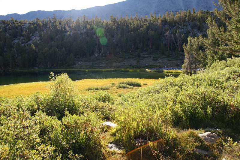
   Below the tree line, there are some meadows and there are so many wild flowers the both side of the trail.   This trail has not only beautiful lakes, but also there are many wild flowers, small streams.   I think all people enjoy the nature during the hiking.   Morgan Pass is just a little above the tree line and the trail is getting a little steeper in the last section to Morgan Pass.  But is just a moderate slope, not very steep.  The view is changed above the tree line.  The trail is getting rocky and no green color any more.   We turned around at the Morgan Pass, but the trail continues toward Upper / Lower Morgan Lakes.   Just another half miles to Upper Moran Lake and a little more than a mile to Lower Morgan Pass.  

 East side of Morgan Pass, 
it is completely different view from the west side

   On the way to Morgan Pass, it was really clear sky.  We did not see any clouds at all.   However, on the way back, many clouds were shown and started feeling cold wind.  It could be a sign for a shower.   The last hiking here three years ago, right after we were back to the trail head, a shower started.  This time we did not caught any shower, but it could happen a few hour later based on the sky above mountains.


From Box Lake, more cloud on the way back


   Some of groups we saw on the trail, they spend a few nights on the trail and they told me it was great camping next to lakes.   It would be a good option to consider overnight hiking there.  However, people plan to do overnight hiking require permit.  No permit is required for day trip hikers.  The permit can be issued at White Mountain Ranger Center in Bishop where about 30 miles away from the trail head is.
   Other notes for this time, there were so many mosquitos during the hiking.  They are annoy.  I guess this is where the name of the trail head is from.  I do not know why, but there was no problem last hiking three years ago.


8/24/2013

Little Lakes Valley Hiking

Little Lakes Valley Hiking

Long Lake

Last weekend, August 17, 2013, we went hiking to Little Lakes Valley.  This is really nice area for family hiking.

Little Lakes Valley is located a little northern part of Bishop CA near CA395.  It is about 250mils away, 5~6 hours drive from San Francisco Bay area.  We drove Yosemite National park along CA120.  Yosemite itself is really beautiful nice area.  But it was really crowed in summer time.

In June this year, one of my friend visited Little Lakes Valley and she posted really beautiful photos to Facebook.   That is why I really wanted to visit there as well.  This year our family had been very busy for house hunting.  Due to very crazy housing market, we needed to look at open houses almost all weekend since April.  We did not have no time to go hiking this early summer.

Finally,  our offer was accepted mid July and we were getting some time to go camping and hiking.


Location


About 25 miles before Bishop from north side of CA395, Little Lakes Valley is located along Rock Creek Rd from CA395.  The end of the road is called Mosquito Flat where is the trail head of this hiking trail.  The first day we arrived there around 11am.  The parking lot was full and no space to park at the end of the load.
People need to be back a few miles to park their car.  No street parking is allowed due to narrow road.

 Trail head

So that, we gave up to go hiking on the first day and went back to Rock Creek Lake to spend the rest of the day.  Rock Creek Lake is really nice place for kids.  There is a nice creek near parking lot.  Also, nice camp sites near creek and the lake.  Many people were fishing and caught some fish.  Probably reserving a camp site earlier and stay that camp site would be really nice!
 Beautiful sky from Rock Creek Lake

The next morning, we got up earlier and went to the trail head around 8am.  We could park a nice spots at the end of the road.  The trail head elevation is about 3000m from sea level.  (about 9,000FT).  The trail is slowly getting elevation to about 3400m at Morgan Pass.  Due to a little high altitude, we probably need to pay attention for high altitude sickness, especially kids.

 Nice view near trail head!
First Lake, Mack Lake
Marsh Lake
Heart Lake
Long Lake
Around tree line
 
West side from Morgan Pass
East side from Morgan Pass

Along the trail, there are many small lakes and we really enjoyed nice view almost everywhere on the trail.  We have some little kids and they looked they had high altitude sickness, therefore we decided to turn back from Morgan Pass.  The trail is continue to the east side and some of people continue hiking there.

Round trip to Morgan Pass is about 7.5 miles (12km), about 5 hours hiking with kids.  

This is really nice trail, I strongly recommend to the other people!

(End)